


BREWER Voting District, Howard County, Arkansas
About
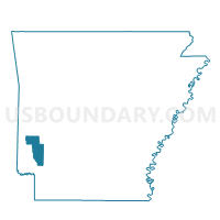
Outline

Summary
| Unique Area Identifier | 526648 |
| Name | BREWER Voting District |
| County | Howard County |
| State | Arkansas |
| Area (square miles) | 22.63 |
| Land Area (square miles) | 22.44 |
| Water Area (square miles) | 0.19 |
| % of Land Area | 99.17 |
| % of Water Area | 0.83 |
| Latitude of the Internal Point | 34.04705880 |
| Longtitude of the Internal Point | -93.86287670 |
Maps


Graphs
Select a template below for downloading or customizing gragh for BREWER Voting District, Howard County, Arkansas


Neighbors
Neighoring Voting District (by Name) Neighboring Voting District on the Map
- CENTER POINT 1 Voting District, Howard County, AR
- HOLLY CREEK Voting District, Howard County, AR
- Mine Creek Voting District, Hempstead County, AR
- MUDDY FORK Voting District, Howard County, AR
- Murfreesboro West 1 Voting District, Pike County, AR
- NASHVILLE TWP 1 Voting District, Howard County, AR
Top 10 Neighboring County Subdivision (by Population) Neighboring County Subdivision on the Map
- Nashville township, Howard County, AR (6,377)
- Mine Creek township, Hempstead County, AR (1,535)
- Center Point township, Howard County, AR (601)
- Brewer township, Howard County, AR (400)
- Brewer township, Pike County, AR (309)
- Muddy Fork township, Pike County, AR (249)
- Holly Creek township, Howard County, AR (219)
- Muddy Fork township, Howard County, AR (132)
Top 10 Neighboring Unified School District (by Population) Neighboring Unified School District on the Map
Top 10 Neighboring State Legislative District Lower Chamber (by Population) Neighboring State Legislative District Lower Chamber on the Map
- State House District 21, AR (27,003)
- State House District 23, AR (26,178)
- State House District 3, AR (25,835)
Top 10 Neighboring State Legislative District Upper Chamber (by Population) Neighboring State Legislative District Upper Chamber on the Map
Top 10 Neighboring 111th Congressional District (by Population) Neighboring 111th Congressional District on the Map
Top 10 Neighboring Census Tract (by Population) Neighboring Census Tract on the Map
- Census Tract 4801, Hempstead County, AR (5,344)
- Census Tract 9502, Howard County, AR (4,988)
- Census Tract 9535, Pike County, AR (4,554)
- Census Tract 9501, Howard County, AR (4,108)